Van Wert County: The Middle of Everywhere
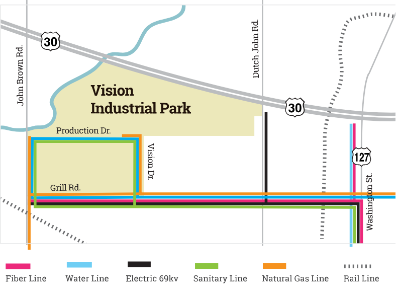

Utilities
- Electricity – American Electric Power
- Natural Gas – Dominion Energy
- Water – City of Van Wert – Excess Capacity 2,000,000 GPD
- Wastewater – City of Van Wert – Excess Capacity 750,000 GPD
- Fiber – TSC or CenturyLink – 10 gigabyte available

Access to rail, highway, and air
Highway Infrastructure
- U.S. Highway 30 (4-lane highway)
- U.S. Highway 127
- U.S. Highway 224
- I-75 (37 miles)
- I-69 (37 miles)
- I-70 (90 miles)
- I-71 (118 miles)
Airport Infrastructure
- Van Wert Regional Airport, 2 miles
- Fort Wayne International, 37 miles
- Dayton International Airport, 90 miles
- Detroit Metropolitan Airport, 148 miles
Railroad Infrastructure
- Local freight service is provided by Chicago, Fort Wayne + Eastern Railroad – Genesee & Wyoming.
- Van Wert Terminal, 3 miles

Toledo Port
The Toledo Port handles international shipments utilizing the Great Lakes St. Lawrence Seaway System and the Ohio Mississippi River system. Shipments through the Great Lakes / St. Lawrence Seaway are brought in on ocean ships capable of carrying lots of up to 25,000 metric tons per voyage. Midwest Terminals of Toledo has two Liebherr LHM 280 mobile harbor cranes. Midwest Terminals has on-dock rail connectivity with CSX, which services the dock several times weekly. They also have inter-line arrangements with Norfolk Southern. CSX and Norfolk Southern connect to Genesee & Wyoming Inc.’s Chicago, Fort Wayne & Eastern Railroad (CFE) to move products to Van Wert.
Cincinnati Port
A single-provider rail connection is available from the Port of Cincinnati and the Ohio River to Van Wert via Genesee & Wyoming Inc.’s Indiana & Ohio Railway (IORY) and Chicago, Fort Wayne & Eastern Railroad (CFE). This connection allows users in northwest Ohio to take advantage of river access through two affiliated and well-established regional rail lines without needing a Class-1 rail carrier. IORY/CFE can establish a single rate and coordinate service and equipment. Cars move north on the IORY to Lima and the Toledo area and can also connect there to western points such as Van Wert. Commodities currently moving via this service include pig iron, fertilizer, salt, and petcoke. Coal, steel, and minerals also move via the related river terminals.
Distance to Regional Major Cities
- Fort Wayne, Indiana, 34 miles
- Lima, Ohio, 32 miles
- Toledo, Ohio, 95 miles
- Dayton, Ohio, 97 miles
- Columbus, Ohio, 126 miles
- Indianapolis, Indiana, 143 miles
- Cincinnati, Ohio, 150 miles
- Detroit, Michigan, 154 miles
